Mapping Irish Communities in Australia
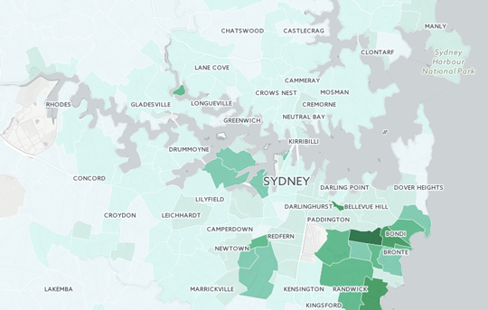
The Consulate has developed two maps revealing the concentration of Irish born residents and residents claiming Irish ancestry across Australia. The two interactive maps are based on data collected in Australia’s 2011 census.
These maps are intended to serve as a resource for the Irish community in Australia, in particular for community and welfare groups, which may be able to use the maps to better target their services. When the results of the 2016 census are published we hope to be able to add new data to the maps so that shifts in the Irish population in Australia can be better tracked. The maps are also a vivid illustration of the deep links between Ireland and Australia.
Click on the image below to be visit the interactive maps.
The map for Irish Born shows the number of residents in a particular area who said they were born in Ireland while the map for Irish Ancestry shows the number of residents who claimed Irish heritage.
You can explore the maps by clicking on individual areas or you can use the search function (which will display totals at city, state and territory level e.g. for Greater Perth or New South Wales). When you select a particular area the total population in that area will be displayed along with the number of Irish born residents or residents declaring Irish ancestry as well as the percentage of the overall population this represents.
There is also a calculator function which allows you to add up populations from a number of different areas.
The maps may be found here: irishcommunitymapsaustralia.net


